

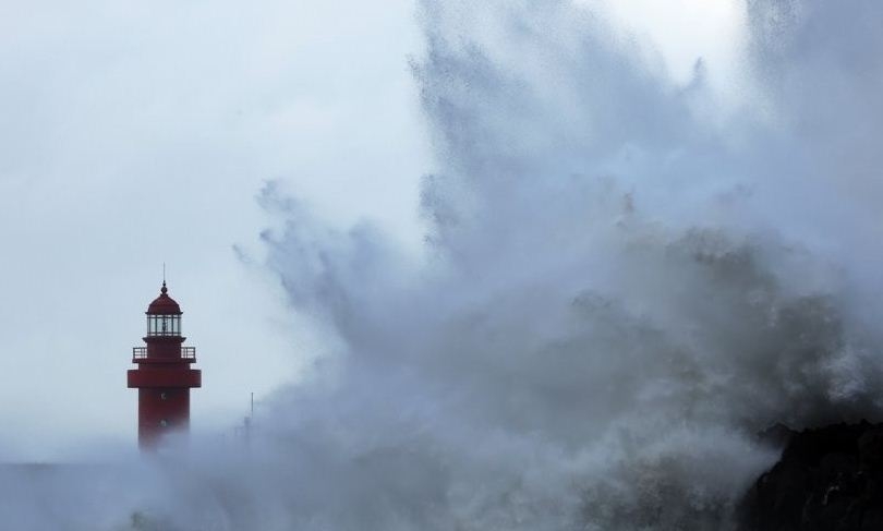
Seoul, Sep 4 (SocialNews.XYZ) Typhoon Hinnamnor is forecast to reach waters off Jeju Island this week as a "super strong" typhoon, the strongest on a four-tier scale, the state weather agency said Sunday.
According to the Korea Meteorological Administration (KMA), the typhoon, the 11th this year, is expected to arrive 460 km south-southwest of the southern island of Jeju around 9 a.m. Monday, with an atmospheric pressure of 920 hectopascals at its centre and a maximum wind speed of 54 meters per second.
Typhoons are classified into four categories, from medium to strong, very strong and super strong, Yonhap news agency reported.
Super strong refers to typhoons with a maximum wind speed of at least 54 meters per second.
By 9 p.m. Monday, Typhoon Hinnamnor is forecast to reach waters 180 km south-southwest of Jeju as a "very strong" typhoon before moving further north to 20 km north-northwest of the southeastern port city of Busan by 9 a.m. Tuesday, according to the KMA.
The typhoon's strength when it reaches Busan is forecast to weaken to "strong," with an atmospheric pressure of 950 hectopascals at its centre and a maximum wind speed of 43 meters per second, making it the strongest typhoon ever to make landfall in South Korea.
According to the Central Disaster and Safety Countermeasures Headquarters, preliminary weather advisories were issued in the southern cities of Gwangju, Busan, Daegu and Ulsan and in the surrounding provinces of South and North Jeolla and South Gyeongsang at 5 a.m. Sunday.
The warnings came a day after an advisory was issued over Jeju.
Parts of the country received rain on Sunday as a result of the approaching typhoon, which has been travelling northward from waters 320 km east-northeast of Taipei, Taiwan.
The country is expected to receive between 100 and 300 millimeters of rain between Sunday and Tuesday, with the mountainous areas of Jeju receiving more than 600 millimeters, the KMA said.
On Tuesday, the country could receive between 50 and 100 millimeters of rain per hour, a level similar to that seen during record rainfall in early August.
The typhoon could also bring record strong winds, with the KMA forecasting maximum speeds of 40 to 60 meters per second in Jeju and other coastal areas between Monday night and Tuesday.
The current record is 63.7 meters per second measured in the eastern coastal city of Sokcho on October 23, 2006.
No casualties or property damage have been reported from the effects of Typhoon Hinnamnor so far.
More than 600 trails in national parks across the country will be closed starting 5 p.m. Sunday. Operations of 46 ferries serving 31 routes have already been suspended, while the local governments of Jeju, South Jeolla Province and other nearby jurisdictions have ordered some 16,000 vessels to move to safety.
At President Yoon Suk-yeol's orders, the government on Saturday raised the typhoon alert level by one notch to "yellow" from "blue."
Source: IANS
About Gopi
Gopi Adusumilli is a Programmer. He is the editor of SocialNews.XYZ and President of AGK Fire Inc.
He enjoys designing websites, developing mobile applications and publishing news articles on current events from various authenticated news sources.
When it comes to writing he likes to write about current world politics and Indian Movies. His future plans include developing SocialNews.XYZ into a News website that has no bias or judgment towards any.
He can be reached at gopi@socialnews.xyz